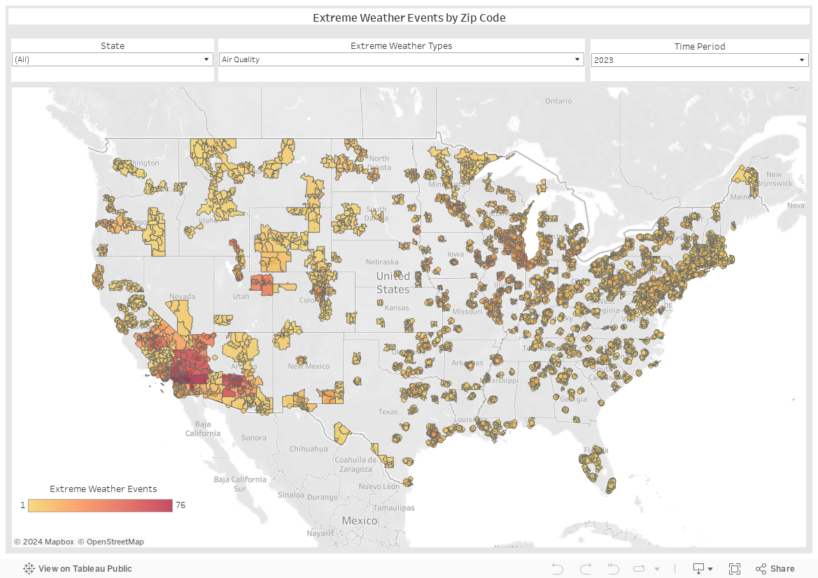
Extreme Weather by Zip Code
Use any time to match local extreme weather to the people experiencing it. Use the map and download the data to create effective, hyper-local strategies.
Source: Free, public extreme weather data from NOAA & AirNow; maps created by the Data Strategy team at the National Wildlife Federation and the Innovation Hub.
To download the impacted zip codes, click the ↓ in the lower right and select Crosstab, Weather Export, Download.
To download the impacted zip codes, click the ↓ in the lower right and select Crosstab, Weather Export, Download.

Innovate With Us
We are in this together – and welcome your inquiries, contributions, and ideas.
Reach out to: